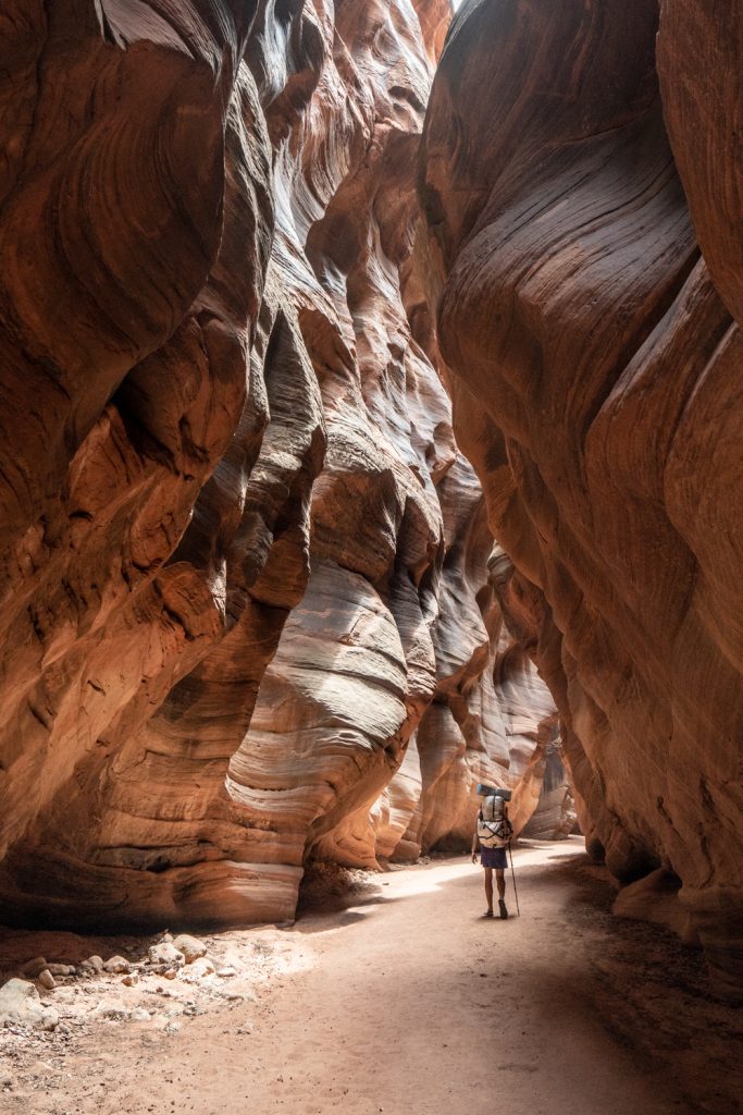
Backpacking Buckskin Gulch and Paria Canyon is one of those dazzling trips worthy of bucket lists the world over. Over the course of about 45 miles, you’ll travel through some of the most mind-blowing scenery the American Southwest has to offer. Permits and suitable conditions for this hike are hard to come by, and I feel extremely lucky I was able to get in on a trip. If you ever have the opportunity to explore this area and conditions are looking good, clear your calendar and go!
This route is done as a point-to-point hike, meaning you need to arrange a shuttle. The logistics are admittedly a headache, since driving from the Buckskin Gulch or Wire Pass area to Lee’s Ferry (where you’ll finish the hike) takes a couple hours each way, consuming about half a day. Since we are local (living in northern AZ), we managed the whole thing with our own vehicles, but there are a number of private shuttle operators in the area that can help you handle logistics.
The Paria River is a tributary of the Colorado River that, in its entirety, meanders almost 100 miles. Paria (pronounced puh-REE-uh) is a Paiute word, and is not related to the English word “pariah”. I’ve seen a few different translations, but most commonly, it translates to “muddy water”. Buckskin Gulch, which feeds into the Paria, is the longest slot canyon in the world. Its magnificent walls have been sculpted by the powerful forces of the Southwest’s flash floods.
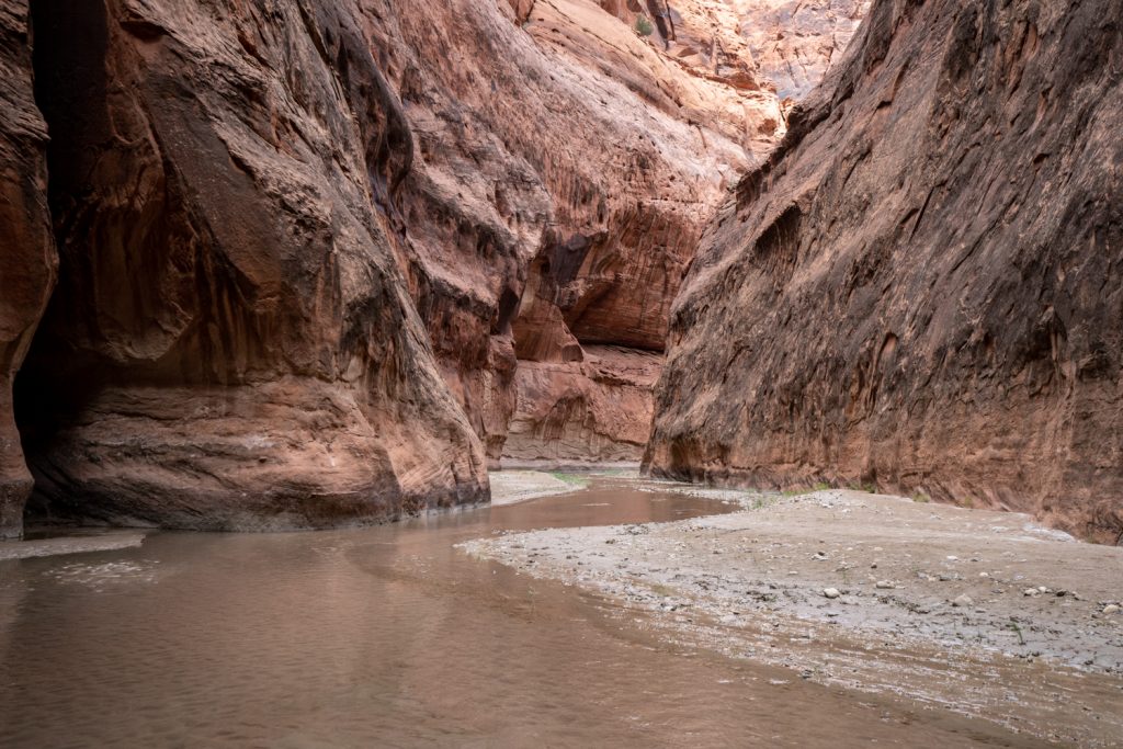
This route is not really a maintained trail. Rather, it follows the natural path of the flow of water. It would be very difficult to get lost for most of this hike, so long as you follow the canyon walls and the river bed. Keep going downstream, and you’re bound to hit the Colorado River eventually.
Our trip took place in early-mid May 2021. Getting the timing right for this trip can be tough, and we were fortunate to get nearly flawless weather. The desert of the Southwest is extraordinarily unforgiving: too early, and nights are frigid in between the tall canyon walls. And only a few weeks later, daytime temps rise to dangerously scorching levels. Besides that, conditions in Buckskin Gulch are highly variable, with the possibility of chest-deep water depending on seasonal weather patterns in the region. The most popular times of year for this hike are spring and fall, when weather is more mild and dry.
For reference, during my trip, USGS data reported the Paria River’s flow rate below 1.0 cubic feet per second from the upstream measurement location near Kanab, and less than 5.0 cfs at Lee’s Ferry for the entire duration of our trip. This is a very low flow rate, so calibrate your expectations based on current data.
One of the most important considerations for hiking and backpacking in this area is flash flooding. If it rains virtually at all, rain collects quickly in these canyons. Conditions can rapidly escalate to life-threatening as water rushes into these narrow spaces. There are stories every year of folks getting swept downstream in flash floods in Southwest canyons–don’t be one of them!
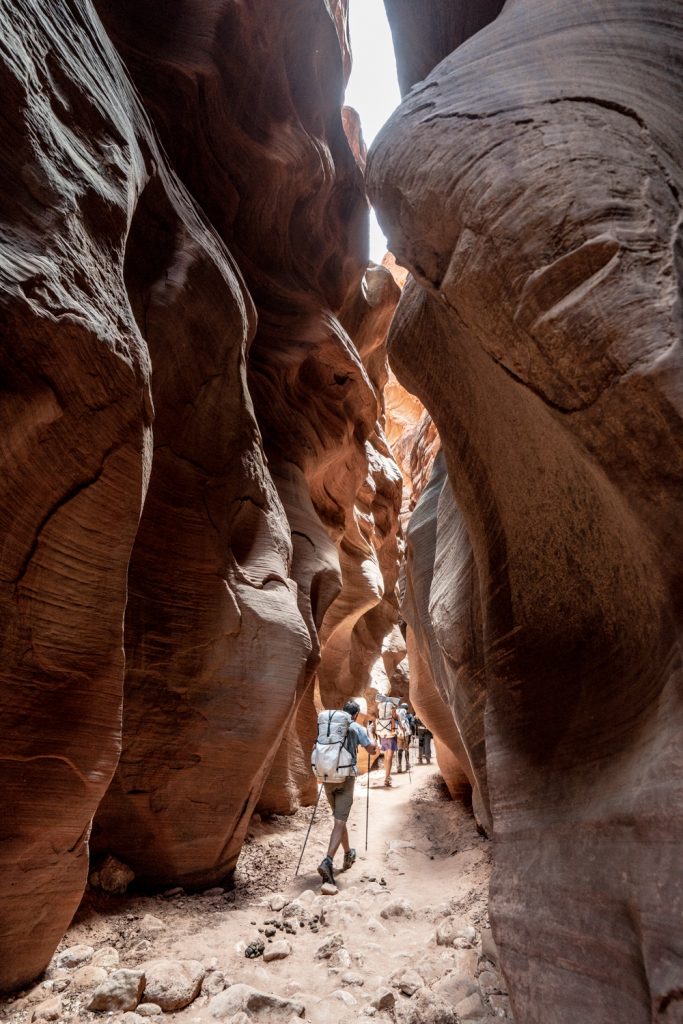
This route also requires permits. Very few permits are offered (currently, 20 hikers per night), and the window of good conditions is very narrow. In other words: scoring a permit is extraordinarily competitive. This is a very ecologically sensitive area and limiting human impact is critical to preserve the beauty of this special place. With human impact in mind, this is also a trip where you’re required to pack out solid human waste using wag bags. That aspect certainly makes this trip a…unique experience, but I promise it’s not that bad!
This post is intended to be a high-level trip report, not a comprehensive how-to guide. Many others have written valuable in-depth resources covering important considerations for route planning, required gear, and risk management for this specific trip. Be sure to read up on those resources before planning your trip to ensure you’re adequately informed.
Our itinerary went like this:
- Day 1: Buckskin Gulch trailhead to camp at Buckskin-Paria confluence – 15 miles
- Day 2: Confluence to camp downstream of Judd Hollow – 10 miles
- Day 3: Judd Hollow to camp upstream of Water Pockets, plus Wrather Arch side trip – 13 miles
- Day 4: Water Pockets camp to Lee’s Ferry – 9 miles
Right before this trip, I mortally damaged my beloved Sony A7II camera body. I wasn’t going to miss the opportunity to photograph this incredible place, though, so I rented a Sony A7R IV from Lensrentals and paired it with my own Sony F4 16-35 mm lens. Given the nature of the landscape, I strongly recommend a wide angle lens. Even if I’d brought a zoom lens with a longer focal length, I don’t think I would’ve used it.
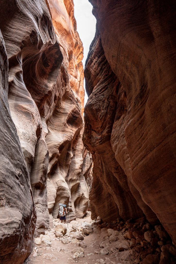
Day 1 | Buckskin Gulch Trailhead to Buckskin-Paria Confluence
We took the entrance from Buckskin Gulch trailhead, opting for the full length of the canyon. The other popular alternative is to take a slight shortcut by entering from Wire Pass to make the first day a bit more manageable. With our starting point, we logged 15 miles the first day. Although this segment includes a slight elevation loss, some sections of the terrain is ankle-busting and rocky, like walking over bowling balls. With our large group of mixed experience levels (ranging from fairly new hikers to seasoned experts), we hiked for about 10 hours, including breaks, before reaching camp.
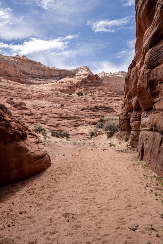
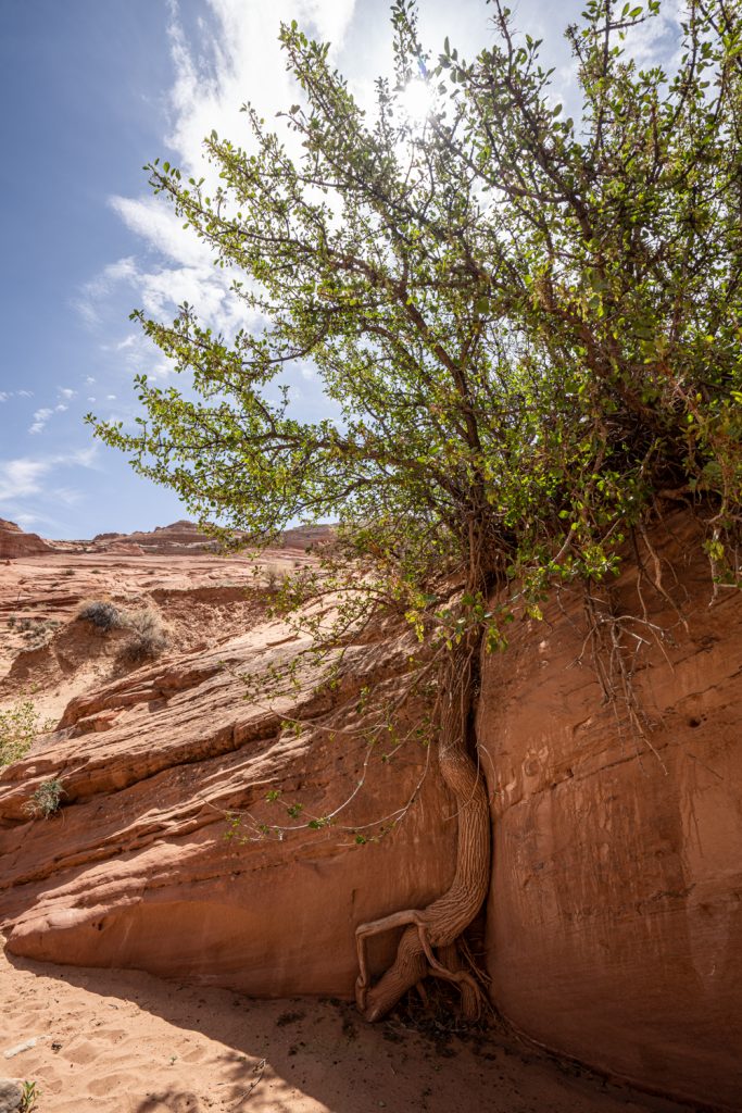
The first couple of miles in the hike are more open until the walls gradually rise to form the slot. It’s so cool to see the canyon literally take shape around you.
Many report water as early as a couple miles into the canyon, continuing virtually unbroken all the way to the Paria River. These conditions would be extremely challenging for a whole host of reasons. Water levels are difficult to predict and highly variable in both spring and fall–neither season is guaranteed to give you good conditions through Buckskin. It all depends on either the snowfall in winter or the monsoons in summer. In recent years, both timing and amount of precipitation are extremely variable, making water in the canyon especially tough to predict. In the months prior to this trip, the region saw average or slightly below average levels of snowfall during winter followed by a dry spring.
Luckily for us, on our trip, we only dealt with wet, muddy conditions in the last mile or so from our first campsite, and most of it was avoidable. The water was only about ankle deep at most. In times of higher water, it’s best to begin your trip from the White House trailhead and follow the Paria River the entire way, bypassing Buckskin Gulch. That alternative route is also a bit shorter overall.
Given the dry conditions, I wore lightweight trail running shoes for the first day. The closed-toed shoes were advantageous because so much of the bed of the canyon was extremely rocky terrain. The extra protection for my toes was much appreciated! Lightweight shoes that drain/dry easily are very necessary.
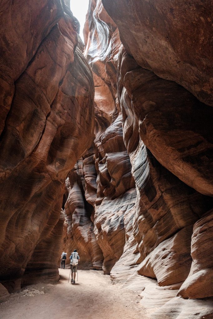
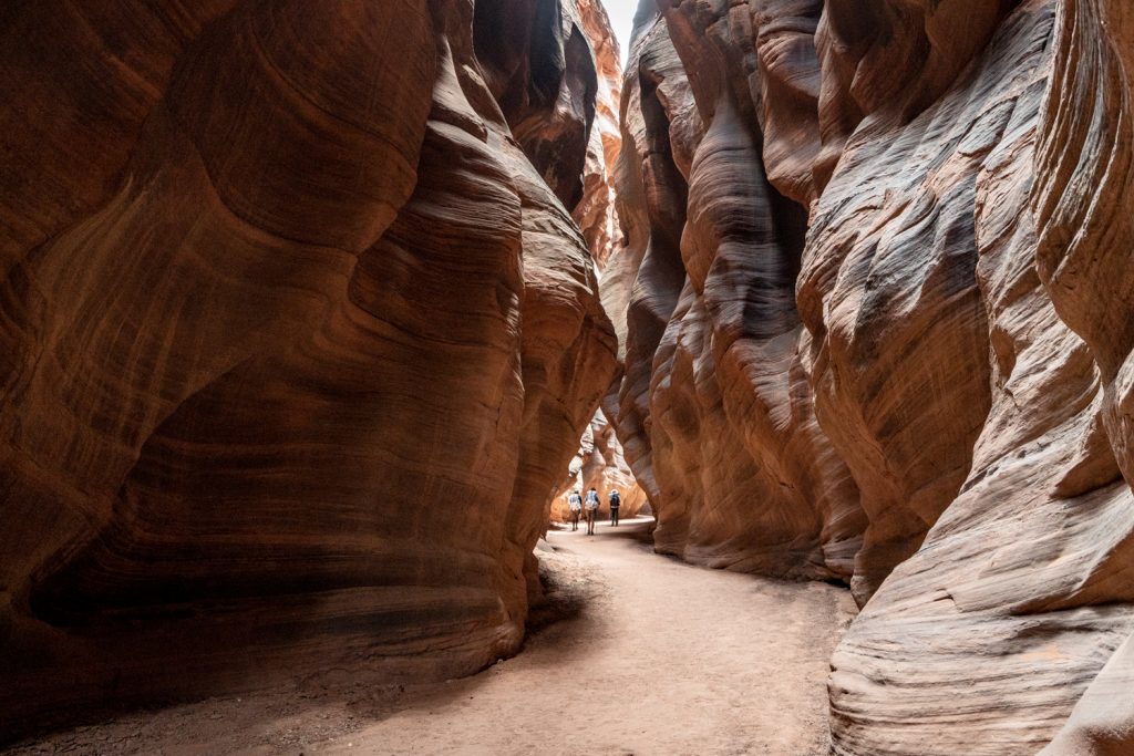
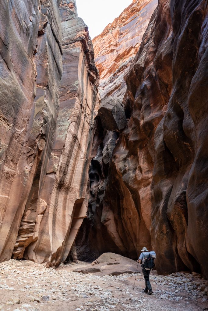
Buckskin Gulch is nothing short of breathtaking. No matter what time of day you’re hiking, the shadows from the high sandstone walls create stunning lighting effects. The slot also creates surreal micro-climates. In sections where barely any sunlight makes it to the bottom of the slot, it would feel like the temperature dropped 10-15 degrees literally within a few steps. Then, you’re right back to a warm patch. It’s wild to experience.
We saw a lot of other hikers for the first few hours, but a couple of miles after the junction with Wire Pass, our group was all that was left.
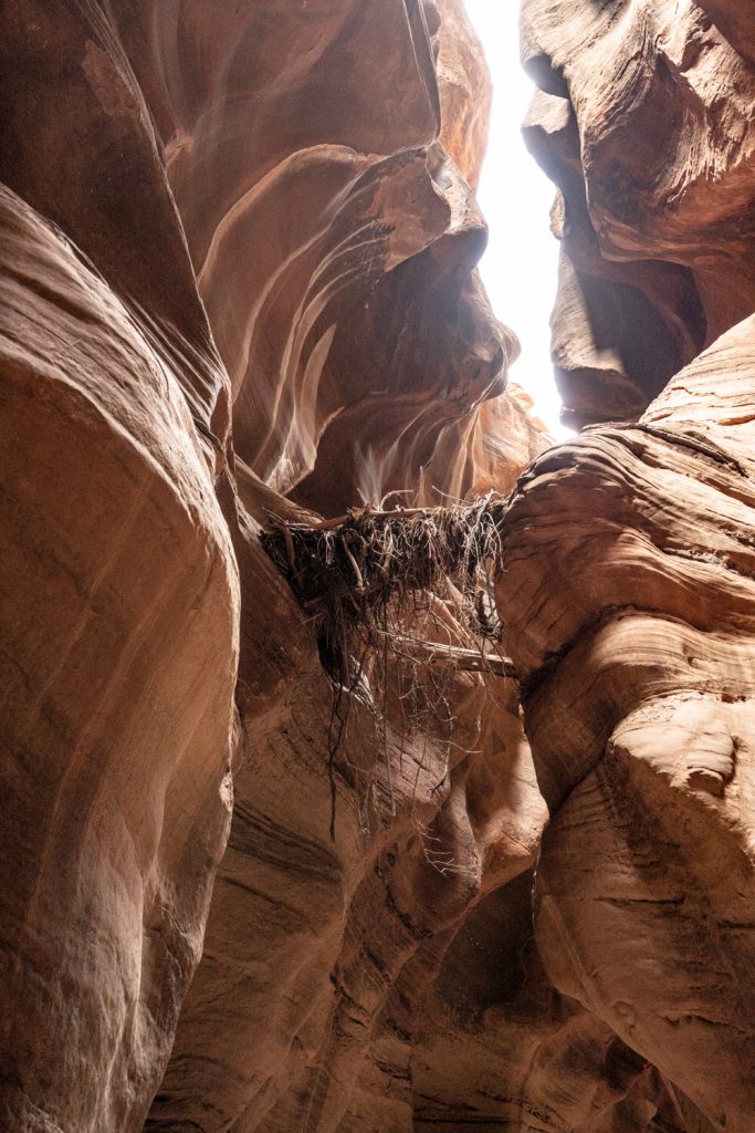
Don’t forget to look up: sometimes you’ll see snags of debris demonstrating the raw power of the flash floods that continue to shape these canyon walls. Since this is a one-way hike, remember to look behind you from time to time, too.
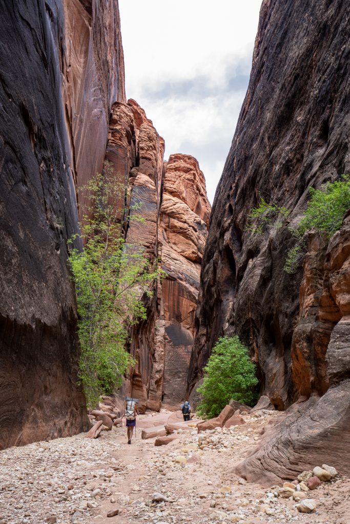
Though most of the canyon has that slotty, wavy look that’s characteristic of the area, occasionally the walls will stand a little straighter and wider. The variety keeps things interesting even though that 15-mile day can sure feel long.
There’s a tricky rockfall a bit more than halfway through the day that requires a bit of strategizing to negotiate. We used partner assists to help us navigate the down climbs. A hand line or two (i.e., a short rope) may also be helpful here. When we went, there was already a rope fixed to a boulder, but be sure to inspect the rope for damage before trusting it with your body weight. Keep in mind that if you were to turn an ankle or otherwise hurt yourself, help would be difficult to come by and you would have a long hike out, so extra caution is warranted. This section was such a fun challenge, though!
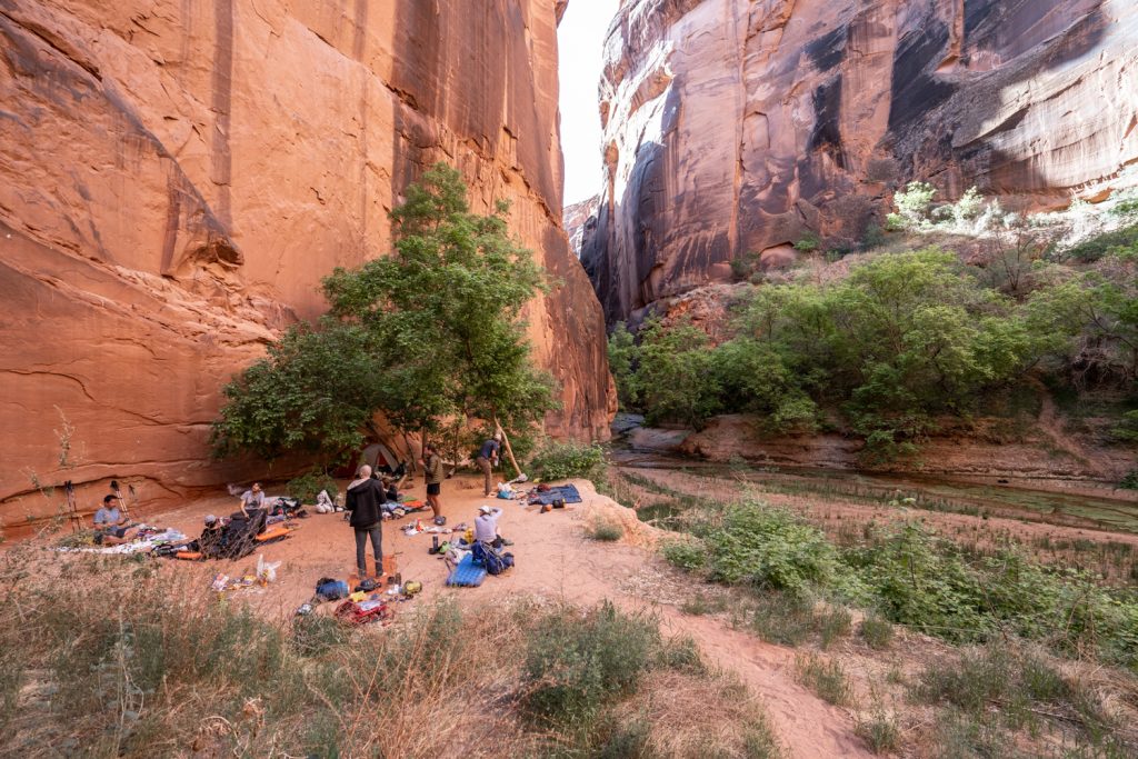
Finally, with our shoulders and feet and just about everything aching, we arrived at an obvious campsite just before the Buckskin-Paria confluence: there’s a large bench on the left looking down-canyon with ample flat ground for tents. There was plenty of space even for our larger group. Here, the slot portion ends and you move into the sheer cliffs of the narrows. Since the water was very shallow and only barely flowing, it was pretty gross: quite turbid and adorned with algae rafts. Although we had backup methods, we used an MSR Guardian to do the heavy lifting. Because the river water is so silt-laden even in the best of times, filtering can be challenging with most setups. There are a couple of natural springs along the route where you can get very high-quality water, but you have to be meticulous about your water planning and attentive to not miss the springs.
Most of our group chose not to pack a tent, instead opting for open air sleeping using a sleeping pad and bag on top of a tent footprint. This is a totally practical solution for this weather and this area. I opted for a little more shelter, bringing just the rain fly and tent poles of my Big Agnes Copper Spur UL2. This fast fly method meant I could forgo the weight of the tent body itself, but still get the perks of some shelter.
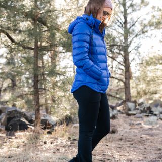
Overnight temps remain chilly in the canyons basically the entire year. Mornings and evenings are quite chilly, and I wore a light puffer jacket and warm hat around camp.
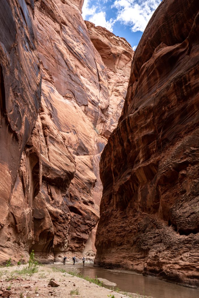
Day 2 | Confluence to Judd Hollow
GPS signal in this kind of terrain is an absolute racket, so getting reliable measurements for distance traveled is a bit challenging. For our second day, we hiked about 10 miles. Our hike started out a little chilly, giving way to mild and pleasant temperatures cocooned between the canyon walls with cool river water to refresh us whenever we wanted.
Shortly after beginning this hike, just downstream of the confluence, you cross the state line, leaving Utah–welcome to Arizona!
A couple miles into our hike, we passed Big Spring, lush and bright with ferns. To date, this spring has been a reliable source of quality drinking water along this route for many years and is the first of several springs along the route.
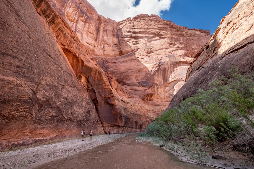
There are scarcely words to describe the awe-inspiring splendor of the Paria narrows. Every curve and bend in the canyon was mesmerizing. The walls towering up to 1,000 feet overhead with the richest colors and textures are nothing short of magnificent. We didn’t see any other hikers all day, which was a nice perk, too.
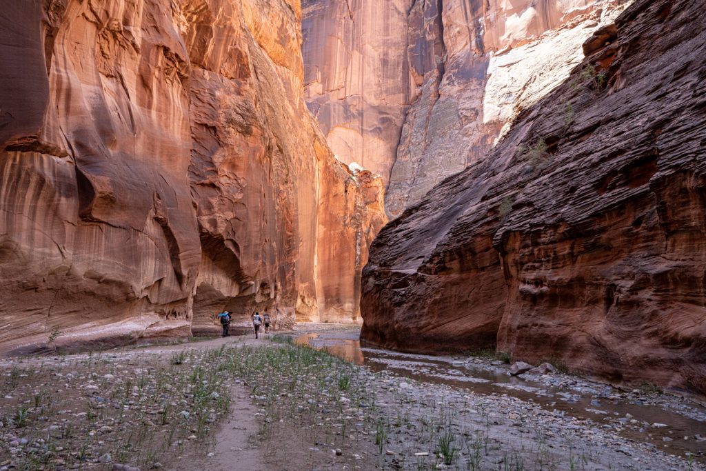
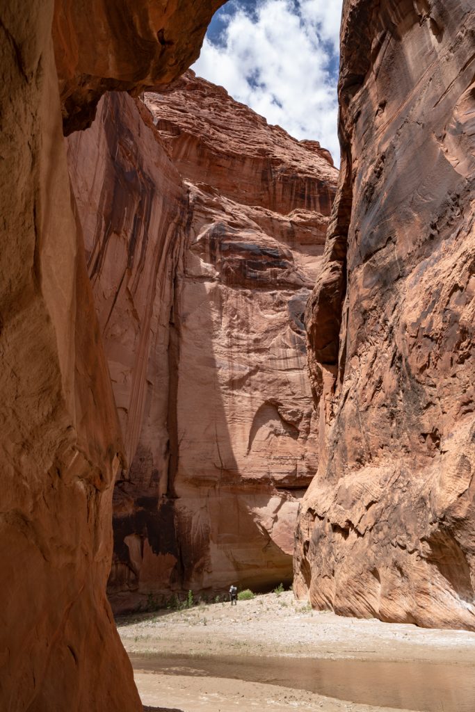
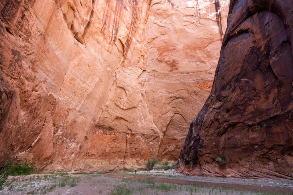
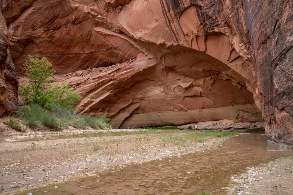
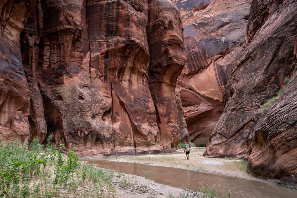
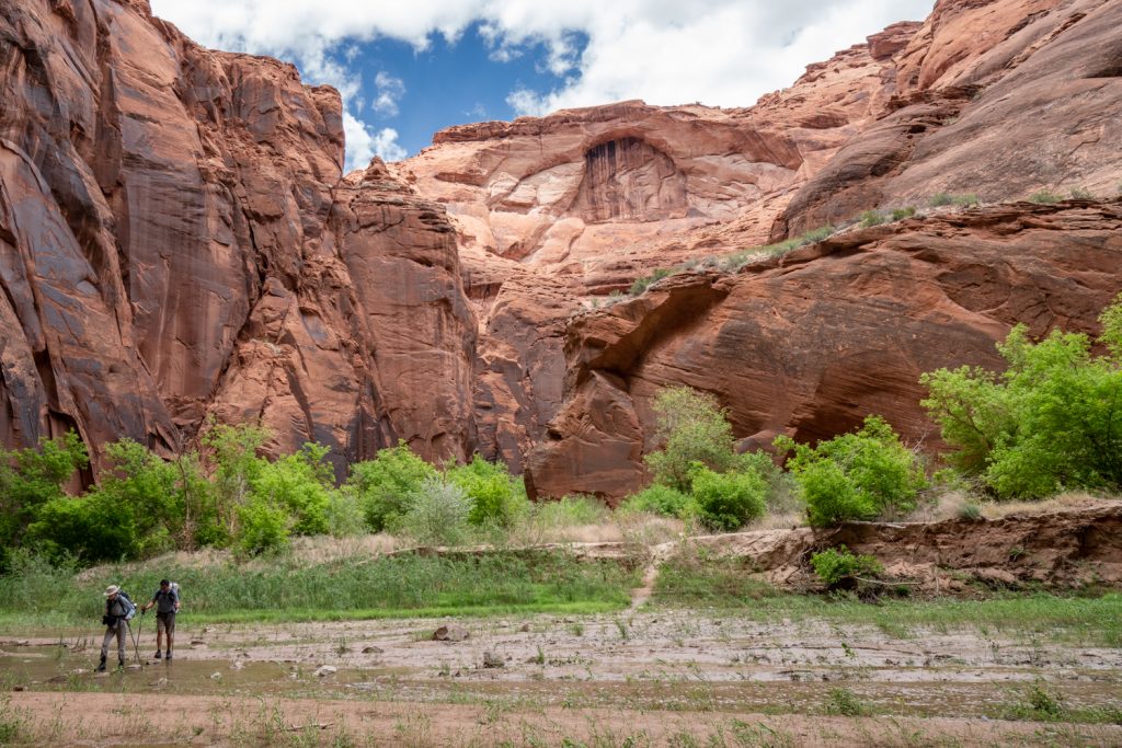
Since day 2 promised wet feet all day, I wore my Bedrock Cairn 3D Adventure sandals, which I’d worn a little bit prior to this trip, but they weren’t fully broken in. Put another way, my feet had not developed callouses in the right places. I ended up with many raw spots that I was able to manage with band-aids or climbing tape, so they never got worse. Other than the hot spots, the sandals were a solid choice for the trip. They gave me the traction I needed and my feet stayed comfortably in place.
While we crossed the river dozens of times, there weren’t many segments where we were wading for more than a minute or two at a time. Usually, we’d cross over and walk along the banks, til that bank ran out and we had to cross again.
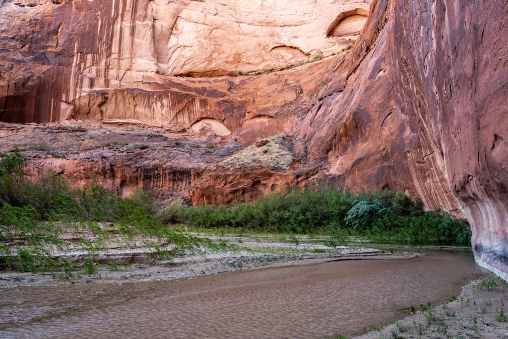
Generally, the water becomes deeper the further downstream you travel. At the beginning of this day, the water was just a splashy trickle, barely covering my feet. By the end of the day, water levels were nearly knee deep. Of course, the flow varies year over year as well as seasonally, so don’t take my report too literally.
This day was much faster than the previous, clocking at about 7 hours from the time we broke camp in the morning to arriving at our second camp. We camped along an obvious high point just a little downstream of Judd Hollow. To me, this was the most beautiful campsite of the trip. We enjoyed the hints of sunset color between the towering canyon walls.
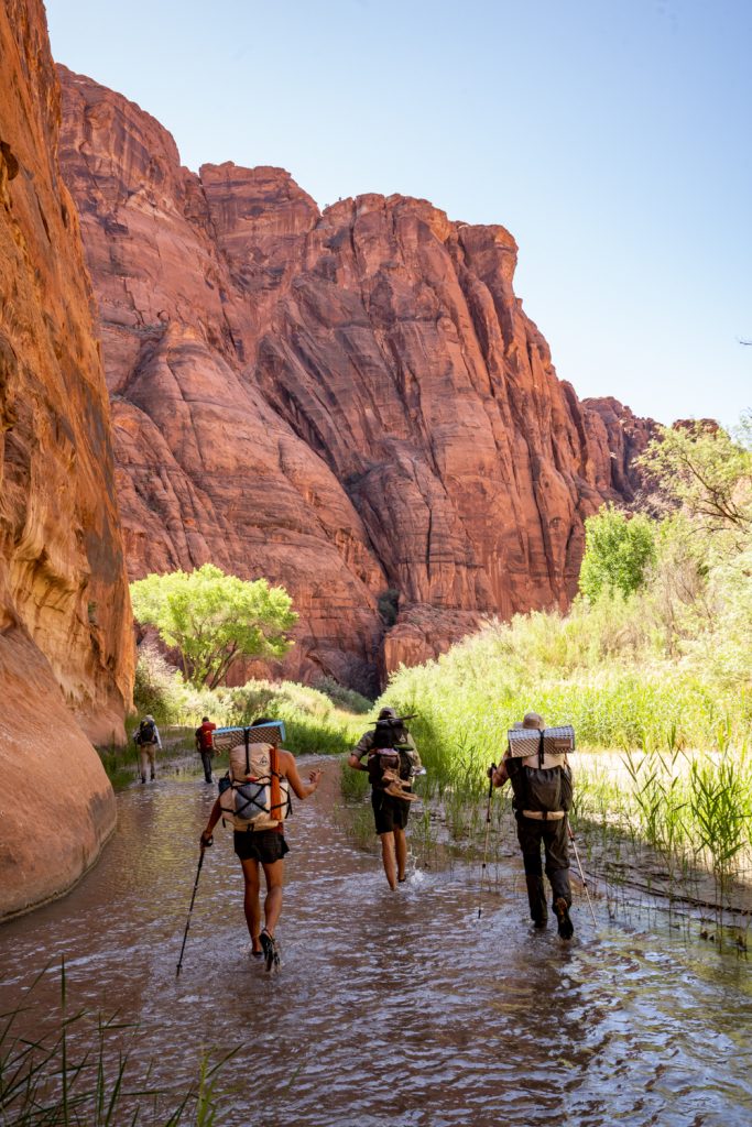
Day 3 | Judd Hollow to Water Pockets, plus side hike to Wrather Arch
Shortly after we begun our day, the walls that were previously high and sheer began to fall away a little bit more. The color and texture of the rock also evolved throughout this section. Many formations here reminded me of the red rocks of Sedona.
The amount of mud and squish-factor was incredibly high. We negotiated crossing after crossing, and as the water got deeper, that came with a lot more squishy, slimy experiences. While the prior day was more splashy, by day 3 we sometimes would be walking through knee-deep river water for longer stretches. Once again, water-friendly shoes are non-negotiable.
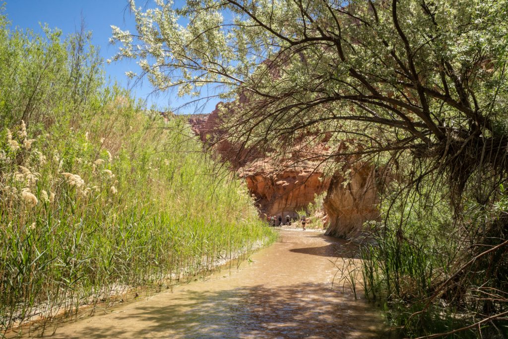
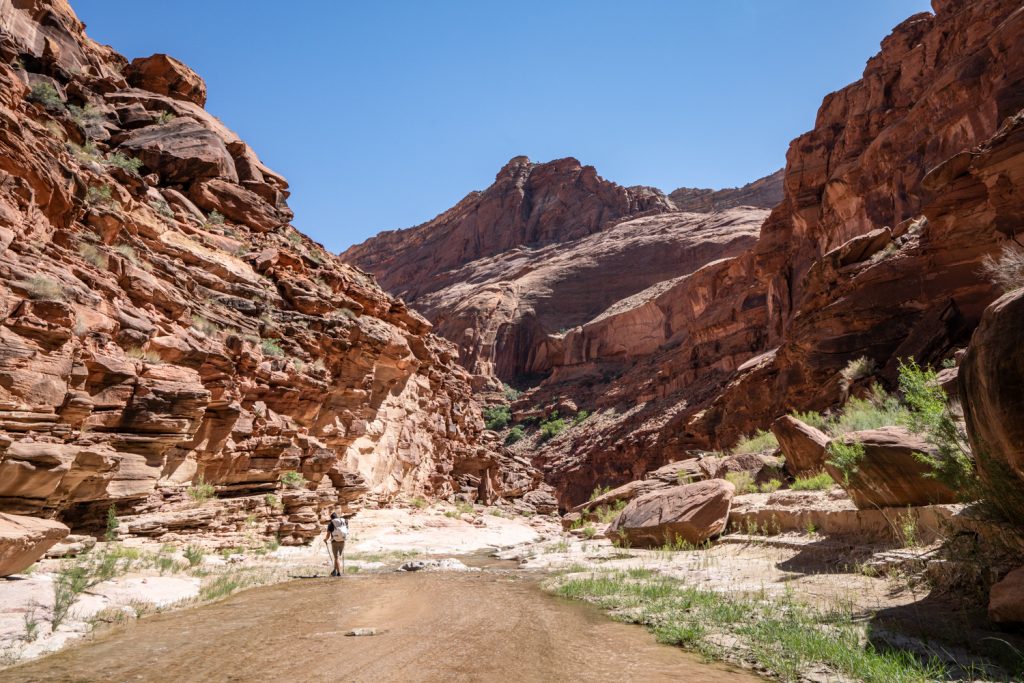
The environment becomes significantly more riparian through this section of the hike. While plant life was sparse and low-laying through most of the canyon the day before, much more sunlight on this section means much more plant life. Willows and tamarisks line the banks, clustered in dense patches. On this day we saw one or two other small groups of backpackers, but only very briefly.
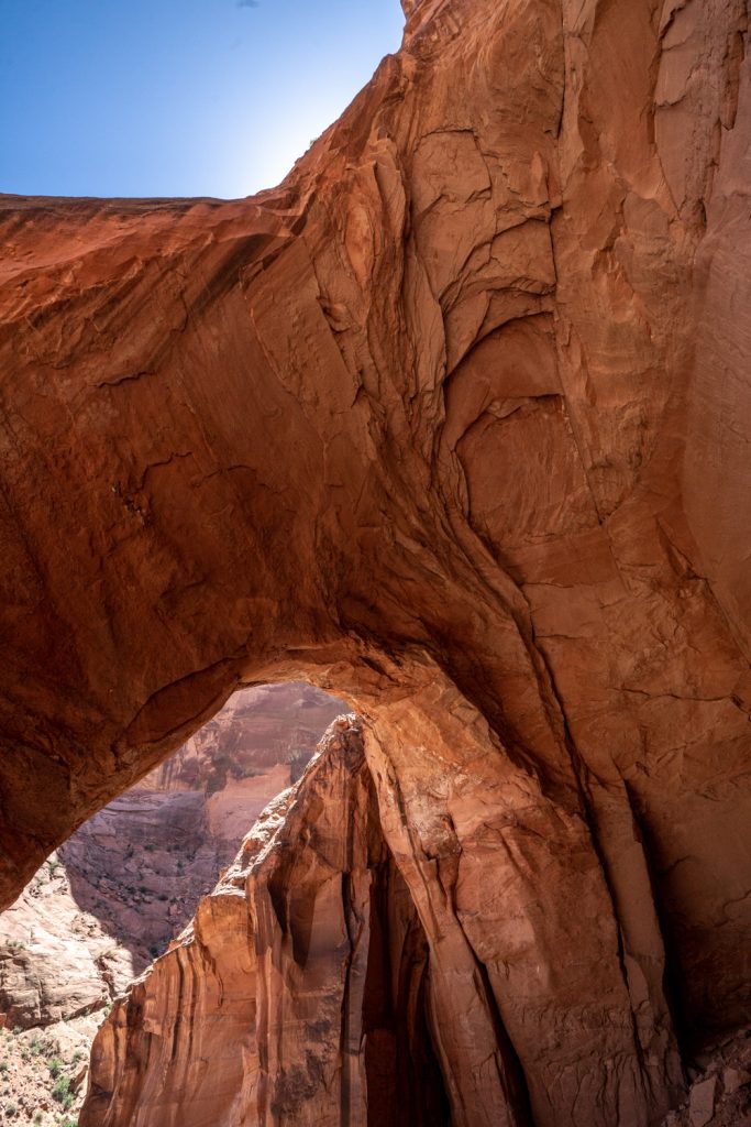
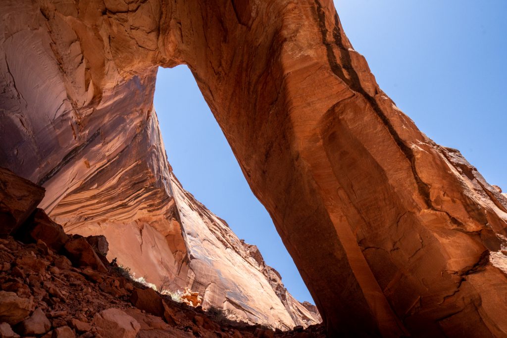
A bit after lunch, we took an optional side trip up to Wrather Arch. The side trek here is short but steep. The trail goes up an unmarked side canyon, so you have to know where to look or mark this location on your GPS beforehand. Parts of the trail had obstacles (like downed trees) and was overgrown, but it was mostly easy to follow. The arch itself is amazingly large and majestic, and you can get right up under it to really appreciate its size. There’s nothing quite like the rich orange-red of the sandstone against a vibrant blue sky. Just stunning!
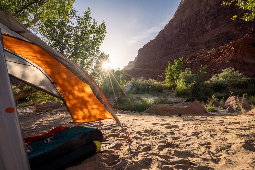
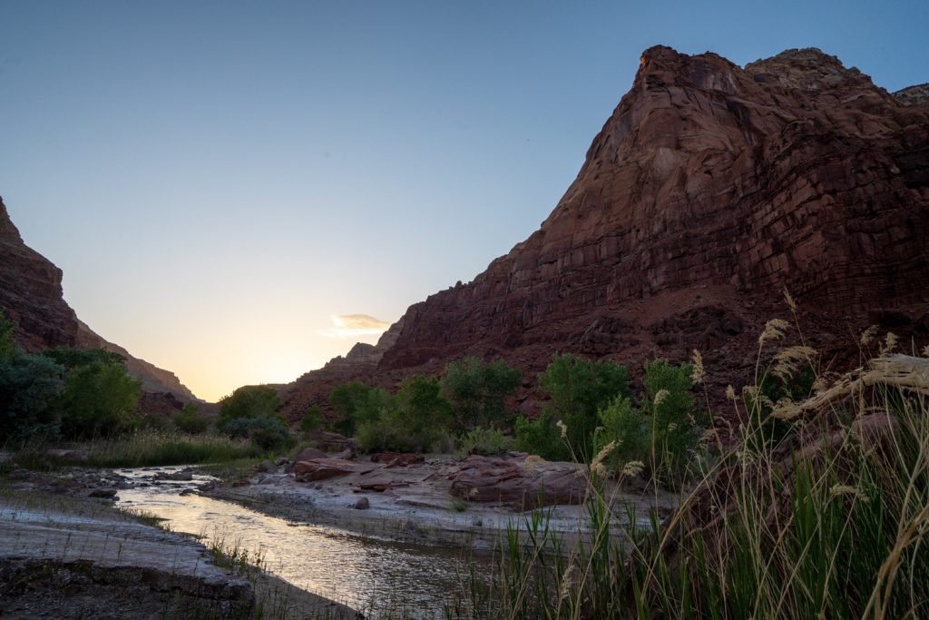
With the spur, we covered about 13 miles on day 3. Even with the additional mileage, our day was again about 7 hours. We set up camp on the left side of the trail, slightly up canyon from Water Pockets. Along this stretch, there are ample opportunities to pitch a tent and settle in with easy access to the river for water. By this point, the canyon walls have fallen away considerably. It feels more like classic southwest canyon country than a lush oasis. The more open conditions also meant this night was much warmer than the previous two. Cooling off in the river was glorious. Looking at the campsite photos, you can really appreciate how much the scenery changed from the beginning of day 2 to the end of day 3.
Day 4 | Hike out to Lee’s Ferry
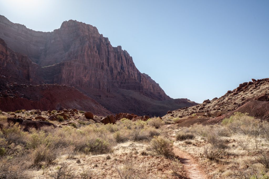
I don’t want to say the last day is bad–that seems pretty harsh. But I do think it’s fair to say it’s the least good. At this point, you’re well out of the Paria narrows, and the walls have opened up significantly on both sides. That said, there’s still enough of a canyon to create an oven effect as the heat radiates off the walls and rocks. This is straight-up Southwest desert slogging. Our day was somewhere in the 80s and 90s throughout, and felt hotter. There’s very little shade, but for most of the day there are opportunities to cool off in the river. We moved slowly, taking plenty of breaks when we did manage to find some shade, and drinking plenty of water that we filtered regularly at river crossings. If hot conditions are expected on your hike, start as early as you can manage. Conditions can be punishing.
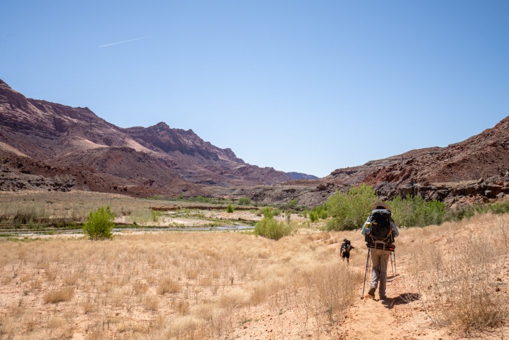
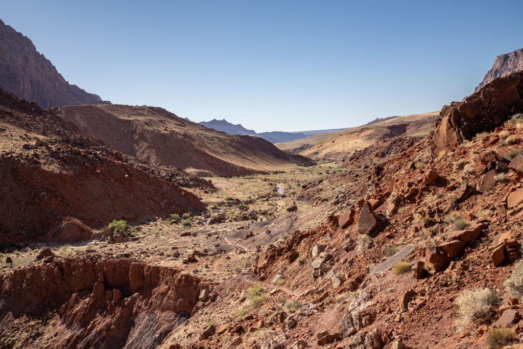
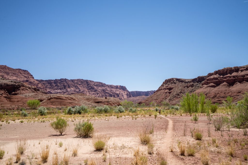
Originally, I thought this day would be relatively dry, so I wore my closed-toed shoes again. To my surprise, there were still about half a dozen water crossings. Much less than previous days, but definitely not a dry day. In any case, it was hot enough that having wet shoes wasn’t much of a bother.
This was our shortest day at only about 9 miles. Moving at a very modest pace to manage heat, we arrived at Lee’s Ferry in about 4.5 hours. This meant we got off the trail with plenty of time to get home and feast on the obligatory post-wilderness meal.
Overall, it’s not hard to see why this is one of the most rewarding wilderness trips I’ve had the privilege of enjoying. I’m especially grateful that the stars aligned and conditions were so smooth for our trip. If you are lucky enough to see it, this is one of those places that will live rent-free in your mind for years to come.


Very cool! Thanks for sharing. I always love your trip/hike posts.
Thanks so much Steph!!! It’s a good excuse to work on my photography. :)
Wow. WOW. Wow.
These photos are badass, and you are a badass for making this journey! Thank you for sharing your trip and letting us live vicariously through your camera.
Thank you for such a wonderful comment! 🥰 It’s always so hard to narrow down the photos, but especially in a place like this!